Johnsbach Valley (Regular)
Operator: University of Graz
DEIMS-SDR Database: Johnsbachtal
Contact: Manuela Hirschmugl, Wolfgang Schöner, Jürgen Fuchsberger
Site description
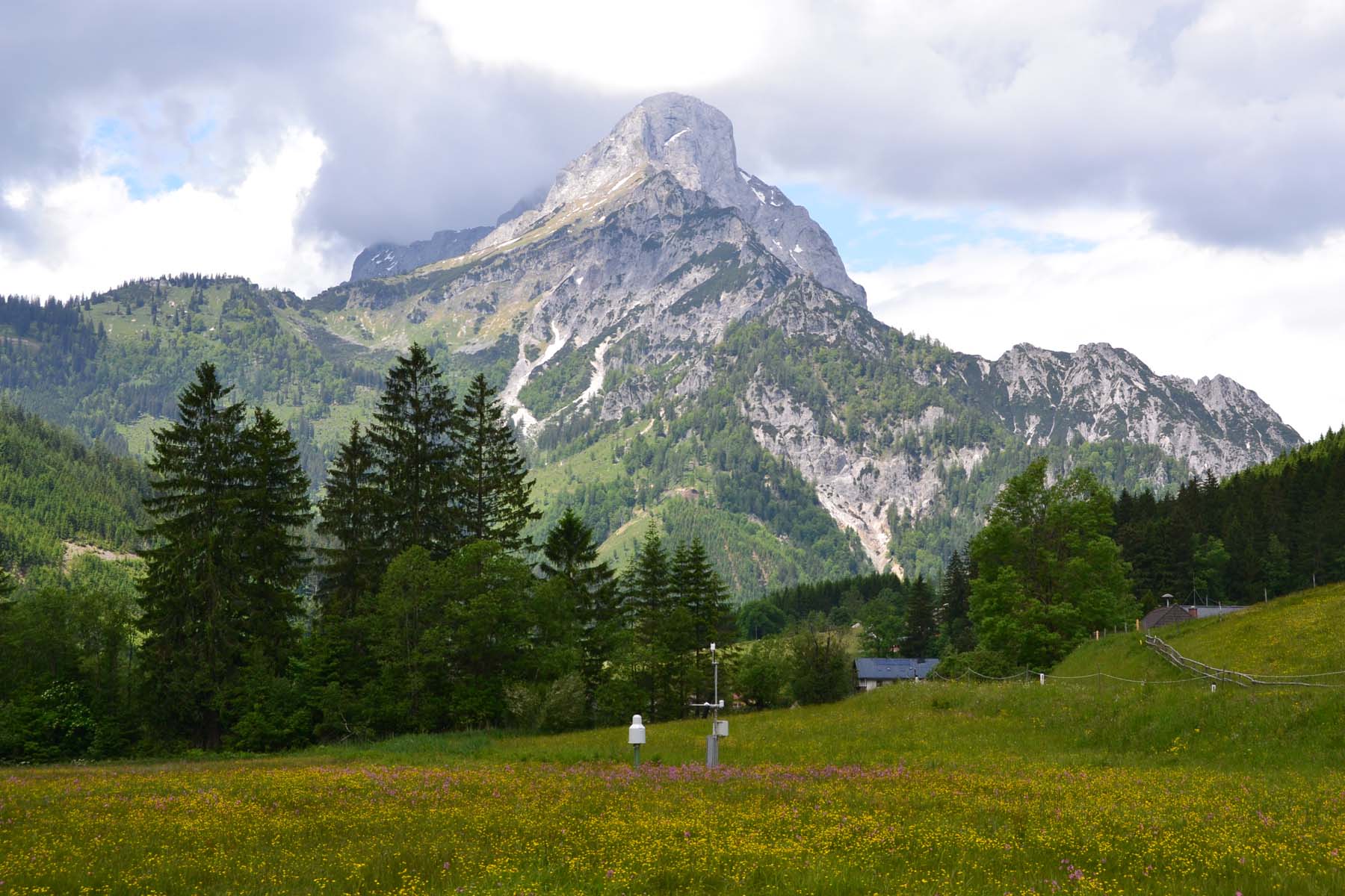
The Johnsbach river basin is a comparatively small, high Alpine river headwatershed situated in the Ennstal Alps (Styria) and covering an area of approximately 65 km². The Johnsbach valley is an area of high diversity in a variety of aspects, geological framework, relief energy, morphological and hydrological dynamics, or gradients in meteorological variables. Similarly, the economic interests are also varying: forest management, Alpine pasture farming, water resource economics, and tourism (mountaineering, recreation, in winter skiing and dog sledding). The northern part belongs to the Gesaeuse National Park. The landscape is dominated by high Alpine rock formations, forests and meadows with highest elevations found at the summit of Hochtor (2369 m). The main concerns of current activities are hydroclimatological measurements, geomorphology and sediment budgets, long-term monitoring, education and training, sustainable tourism and management. A network of hydroclimatological stations has been installed at nine locations ranging from 600 to 2,191 m and instrumented with temperature, precipitation, wind speed and direction, humidity, radation and snow water equivalent sensors. The meteorological stations are supplemented by three river discharge gauges; a runoff and bedload measurement station is currently (Feb. 2014) under construction at the catchment outlet.

Publications
- Fuchsberger, J., G. Kirchengast, and T. Kabas (2018): Release Notes for Version 7 of the WegenerNet Processing System (WPS Level-2 data v7)
WegenerNet Tech. Report No. 1/2018, Wegener Center, University of Graz, Graz, Austria
- Kabas, T., J. Fuchsberger, G. Kirchengast, C. Schlager, and C. Bichler (2018): WegenerNet - Klimaforschungsregion seit mehr als 10 Jahren. ÖGM bulletin 2018/1, 8-15, Österr. Ges. für Meteorologie, Wien
- Rascher, E., Rindler, R., Habersack, H., Sass, O. (2018): Impacts of gravel mining and renaturation measures on the sediment flux and budget in an alpine catchment (Johnsbach Valley, Austria). Geomorphology, 318, 404-420, doi.org/10.1016/j.geomorph.2018.07.009.
- Schlager, C., G. Kirchengast, and J. Fuchsberger (2018): Empirical high-resolution wind field and gust model in mountainous and hilly terrain based on the dense WegenerNet station networks. Atmos. Meas. Tech., 11, 5607–5627
- Schlager, C., G. Kirchengast, J. Fuchsberger, A. Kann, and H. Truhetz (2018): A spatial evaluation of high-resolution wind fields from empirical and dynamical modeling in hilly and mountainous terrain. Geosci. Model Dev. Discuss., 1–26
- Schöttl, S., Rascher, E., Sass, O. (2018): Der Langgriesgraben - Ein dynamischer Raum im Gesäuse und Gegenstand intensiver Forschung. Im Gseis (Nationalpark Gesäuse Magazin) 30: 4-7.
- Fuchsberger, J. und O. Sass (2017): Kooperationsplattform Johnsbachtal: Klima- und Naturgefahrenforschung im Gesäuse, Forschungsplattform Eisenwurzen, e-Wurzen Newsletter 1/17, 1-2
- Lieb G. K., Hasitschka J., Kreiner D., Sass O. (2017): Felsstürze im Gesäuse – zwischen Naturgefahr und Motor für Artenvielfalt. In: Im Gseis 28 (Nationalpark Gesäuse Magazin, Sommer '17), 4–7.
- Rascher, E., Sass, O. (2017): Evaluating sediment dynamics in tributary trenches in an alpine catchment (Johnsbachtal, Austria) using multi-temporal terrestrial laser scanning. Zeitschrift für Geomorphologie, Supplementary Issues, 61(1), 27-52, doi.org/10.1127/zfg_suppl/2016/0358.
- Kabas, T. (2016): Wetter- und Klimadaten im Geographie- und Wirtschaftskunde-Unterricht – das Beispiel des Klimastationsnetzes WegenerNet. Masterarbeit, 93 S., Inst. f. Geographie u. Raumforschung, Univ. Graz, Austria
- Krenn, P. (2016): Kartierung und Evaluierung von Sedimenttransport-Prozessen in der Zwischenmäuerstrecke, Johnsbachtal. Master Thesis, University of Graz, Austria (in German).
- Sass, O., Rascher, E., Rode, M. & Kreiner, D. (2016): Johnsbach in Bewegung. DaSchauHer – Die Kulturzeitschrift für Österreichs Mitte, 37 (2), 8-11.
- Stangl, J., Rascher, E., Sass, O. (2016): Comparative analysis of sediment routing in two different alpine catchments. In: Beylich, A.A., Dixon, J.C., Zwolinski, Z. (Eds.), Source-to-sink-fluxes in undisturbed cold environments. Cambridge University Press, Cambridge, pp. 364-377, doi.org/10.1017/CBO9781107705791.026.
- Grünwald, T. (2014): Das Klimastationsmessnetz im Johnsbachtal und eine erste Auswertung der Daten. Magisterarbeit, 136 S., Inst. f. Geographie u. Raumforschung, Univ. Graz, Austria.
- Scheidl, D. (2014): Improved Quality Control for the WegenerNet and Demonstration for Selected Weather Events and Climate. Scientific Report No. 61-2014, 78pp., ISBN 978-3-9503608-8-2 Wegener Center for Climate and Global Change, Univ. Graz, Austria.
- Strasser U., Marke T., Sass O., Birk S., Winkler G. (2013): John’s creek valley: a mountainous catchment for long-term interdisciplinary human-environment system research in Upper Styria (Austria) Environmental Earth Sciences, Volume 69, Issue 2, pp 695-705
- Strasser, U. (2011): "Integrative Kooperationsplattform Johnsbachtal" - ein langfristig angelegtes Projekt zur Mensch-Umwelt-Forschung in einer komplexen Hochgebirgsregion. In: Forschungsberichte des Nationalpark Gesäuse, Bd. 6, im Druck.
- Gerecke, R. (2009): Quellprojekt Nationalpark Gesäuse - 2. Quellwoche 2008. Bericht i. A. der Nationalpark Gesäuse GmbH, Tübingen im Juni 2009, 11 S.
- Stangl, J. (2009): Gravitative Naturprozesse im Nationalpark Gesäuse - Diplomarbeit, Universität Graz, 156 S.
- Kammerer, H. (2008): Biotopkartierung Gesäuse, Teilbericht Kartierungsbereich Johnsbach inkl. Humlechnergraben. Bericht i. A. der Nationalpark Gesäuse GmbH, Graz, 24 pp.
- Kreiner, D., Zechner, L. (2008, Red.): Der Johnsbach - Schriften des Nationalpark Gesäuse, Bd. 3 Nationalpark Gesäuse GmbH
- Lieb, G., Premm, M. (2008): Das Johnsbachtal - Werdegang und Dynamik im Formenbild eines zweigeteilten Tales, in: Nationalpark Gesäuse (Hrsg.) Schriften des Nationalpark Gesäuse
- Thonhauser, H. C. (2007): Gewässerstruktur und Verbauuungsgeschichte im Einzugsgebiet des Johnsbaches - Diplomarbeit, Universität Graz, 191 S.
- Haseke, H. (2006): A2 Managementplan. Revitalisierungsprojekt Johnsbach-Zwischenmäuer 2006-2008. Nationalpark Gesäuse GmbH, WLV GBL Enns- und Salzatal
- Seiss, M. (2005): Landschaftsökologische Untersuchungen in Johnsbach unter besonderer Berücksichtigung der klimatischen Verhältnisse - Diplomarbeit, Universität Graz, 82 S.
- Grasser, R. J. (2004): Bodenverhältnisse ausgewählter Standorte im Nationalpark Gesäuse - Diplomarbeit, Universität Graz, 78 S.
- Remich, B. (2001): Geomorphologische Grundlagenerhebung und -bewertung im Projektgebiet Nationalpark Gesäuse - Diplomarbeit, Universität Graz, 58 S.
