-

Der Gossenköllesee auf 2.417m beherbergt eine der letzten Populationen der Donauforelle, aller Wahrscheinlichkeit von Kaiser Maximilian um 1500 besetzt.
Wussten Sie schon?
-

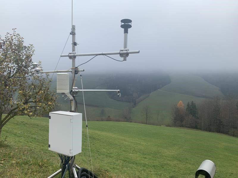
Das Johnsbachtal und seine Umgebung wird durch ein Netz von zehn Klimastationen abgedeckt. Die für alpine Verhältnisse sehr hohe Stationsdichte erlaubt detaillierte geländeklimatische Analysen.
Wussten Sie schon?
-

Das Johnsbachtal deckt mit 592 – 2370 m ü.NN einen großen Höhenbereich mit zahlreichen Vegetations- und Formungsstufen ab.
Wussten Sie schon?
-

Die typische Landnutzung im Johnsbachtal umfasst traditionelle Almwirtschaft, Waldwirtschaft und Tourismus.
Wussten Sie schon?
-

Viele Forschungsarbeiten im Johnsbachtal konzentrieren sich auf Klimatologie, Hydrologie (Quellmonitoring, Abflussentstehung) und geomorphologische Prozesse (Sedimenttransport).
Wussten Sie schon?
-

Im Mondsee Einzugsgebiet werden über meteorologische, hydrologische und pedologische Sensoren Wasser- und Nährstoffflüsse automatisiert in Echtzeit erfasst.
Wussten Sie schon?
-

Der Nationalpark Gesäuse ist mit den Durchbruchstälern der naturnahen Flüsse Enns und Johnsbach und mit seiner hohen Reliefenergie ein prädestinierter Standort für die Untersuchung von Prozessdynamik.
Wussten Sie schon?
-

Der Nationalpark Gesäuse baut auf die mehr als 150jährige naturwissen-schaftliche Forschungstradition des Stiftes Admont auf und führt diese vor allem auf dem Gebiet der Biodiversitätsforschung kontinuierlich fort.
Wussten Sie schon?
-

Das vorrangige Ziel des Nationalpark Gesäuse ist es in der Naturzone natürliche Prozesse ohne Einflussnahme des wirtschaftenden Menschen sicherzustellen.
Wussten Sie schon?
-

Unter den österreichischen Seen weist der Piburger See die längste Datenreihe bezüglich physiko-chemischer Untersuchungen auf.
Wussten Sie schon?
-

Das Rofental in den Ötztaler Alpen ist geprägt durch zahlreiche Gletscher, die flächenmäßig zu den größten Österreichs zählen und mit bis zu 150 Jahren eine außerordentlich lange Beobachtungszeitreihe aufweist.
Wussten Sie schon?
-

Das Rofental in den Ötztaler Alpen ist geprägt durch zahlreiche Gletscher, die flächenmäßig zu den größten Österreichs zählen und mit bis zu 150 Jahren eine außerordentlich lange Beobachtungszeitreihe aufweist.
Wussten Sie schon?
-

Das WegenerNet Klimastationsnetz Feldbachregion ist ein international einzigartiges Pionierexperiment des Wegener Center für Klima und Globalen Wandel der Universität Graz.
Wussten Sie schon?
-

Das WegenerNet Klimastationsnetz Feldbachregion umfasst mehr als 150 Stationen die seit Jänner 2007 die kleinregionale Wetter- und Klimaentwicklung mit neuartiger Genauigkeit erfassen.
Wussten Sie schon?
-

Der Zöbelboden im Reichraminger Hintergebirge ist das bestuntersuchte Karst-Waldökosystem Österreichs.
Wussten Sie schon?
-

Alpine Erschließung, der Kraftwerksbau, die Öffnung des Tales durch Seilbahnen und Lifte sowie die traditionelle Almwirtschaft haben das oberste Stubachtal geprägt.
Wussten Sie schon?
-

Vom Hydrographischen Dienst Land Salzburg bestehen langjährige Registrierungen verschiedener Parameter wie Abfluss, Seetemperatur und Seespiegelschwankungen.
Wussten Sie schon?
-

Im HOAL Petzenkirchen werden hochaufgelöste hydrologische und meteorologische Daten erfasst. Diese sollen für ein besseres Verständnis der einzelnen Prozesse sorgen.
Wussten Sie schon?
-

Das HOAL Petzenkirchen ist eine Kooperation des Instituts für Wasserbau und Ingenieurhydrologie der TU Wien und des Instituts für Kulturtechnik und Bodenwasserhaushalt am Bundesamt für Wasserwirtschaft.
Wussten Sie schon?
-

Im Hydrological Open Air Laboratory (HOAL) in Petzenkirchen werden seit 1945 Daten erhoben.
Wussten Sie schon?
